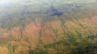
Mapping Ireland's peatlands to help cut carbon emissions / Photo: Justin TALLIS - AFP
Mapping more accurately than ever Ireland's peatlands, which are vital as carbon sinks but whose boundaries can be hard to determine, could help fight global warming, researchers say.
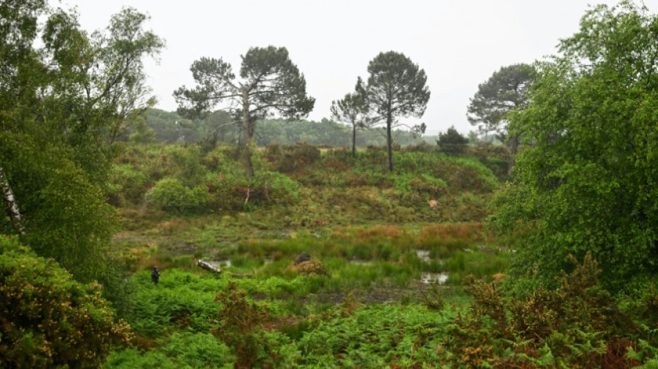
Ireland is pockmarked with patches of dark brown peat soil that make up at least 20 percent of the land cover, according to Eve Daly, a geophysicist at the University of Galway, who co-led a groundbreaking project on finding peat.
"Peatland soils contain comparable amounts of carbon to the likes of rainforests so a more accurate map can lead to better land management decisions and mitigate against greenhouse gas emissions," Daly told AFP.
Her research team developed a new mapping approach using gamma radiation measurements to identify for the first time "transition zones" -- typically hidden under forests and grasslands -- where the soil changes from being peat to mineral-based.
Daly says the area of soil in Ireland considered "peaty" has increased thanks to a new colour-coded "peat/non-peat" map produced by the researchers.
"Improved mapping at higher resolution and locating where hidden organic peat soils are and their extent are key inputs into working out carbon emission factors," she said.
Her project co-leader Dave O'Leary told AFP about 80 percent of Ireland had now been mapped out in patches of "peat" brown or "non-peat" green.
"Few countries have invested in such an incredible data set, which puts Ireland at the forefront of peatland mapping research," he said.
- 'New lens' -
Land use, including farming and peatland draining, is a major source of Ireland's carbon emissions which could see the country failing to meet an EU-agreed climate target to cut emissions by over 50 percent by 2030.
A recent report said Ireland risks an EU fine of almost 30 billion euros if it fails to reach the target and recommended the restoring -- and rewetting -- of thousands of hectares of peatlands to help deliver "massive" cuts in emissions.
"We need to use more modern technologies or use old technologies with new lenses to try and find these hidden peat soils," Daly said.
Ireland's boggy areas are typically located in the middle of the bowl-shaped country which is ringed with hills and low mountains around the coastal areas.
Triven Koganti, an agroecology expert at Denmark's Aarhus University, told AFP that five percent of global greenhouse gas emissions came from cultivated peatlands.
"Historical agricultural draining of peatlands... or to use them as a fuel source has led to significant greenhouse gas emissions," he said.
So "an accurate accounting" of peatland boundaries is needed to achieve "current global initiatives to restore peatlands", he said, adding the Irish research "plays an important role in establishing this".
- 'Bird's eye' technique -
The mapping technique -- described as "bird's eye" by Daly -- is based on gamma-ray data measured by a sensor onboard a plane that has been flown low over Ireland for a decade in a state-funded geophysical survey.
"All rocks and different amounts of soils give off a certain amount of natural radiation but peat doesn't as it's full of organic material," Daly said.
Soils are usually a mixture of broken bits of rock, water and air, but peat soils are distinct from mineral soils as they are formed from decaying plant material, water and air, and contain a very high amount of carbon.
When waterlogged, this carbon is stored in the soil but when water is removed, for example via drainage, peat soils then emit carbon dioxide as the decay process restarts, Daly said.
The state-funded "Tellus" survey began in 2011 and is expected to be completed later this year.
B.Hornik--TPP